
© Santanu Majumdar
Forest Inventory Using Drones and AI
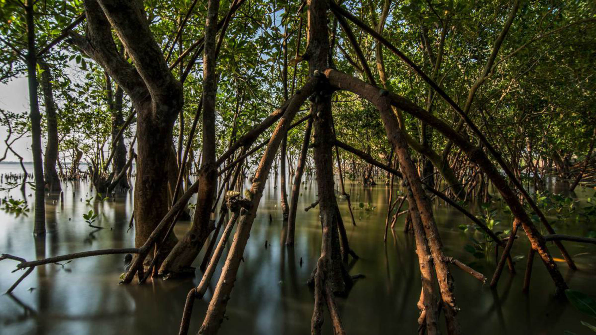
Mangroves are “super trees” – they control a multitude of valuable processes. A new method for tree inventory makes it easier to monitor and protect mangrove forests.
In the battle against climate change, mangroves are important allies – they store up to five times more carbon dioxide than other trees. A recently developed method from researchers in the member institutes of the U Bremen Research Alliance now provides more detailed information about the population of mangrove forests, which can help to protect these.
Dr. Arjun Chennu views mangroves as “super trees” because they thrive in an extremely saline environment, are acclimated to tropical heat and tidal changes with the accompanying fluctuations in salinity, and because their root systems are able to protect coasts from erosion while serving as a nursery for fish and other marine animals. They are particularly unique due to their ability to sequester large amounts of carbon dioxide from the atmosphere and store this in their biomass and in the sediment for centuries, if not millennia. “This makes them particularly relevant, and we really ought to not be indifferent about what happens to them,” Chennu opines.
Exact details about how much carbon is stored in the various mangrove areas are currently not available. Estimates range from four to twenty million tons, which are bound in the tidal forests. Chennu, head of the “Data Science and Technology” research group at the Leibniz Center for Marine Tropical Research (ZMT), and Daniel Schürholz, doctoral researcher at the Max Planck Institute for Marine Microbiology (MPIMM), both member institutes of the U Bremen Research Alliance, wanted to know more.
© Jens Lehmkühler
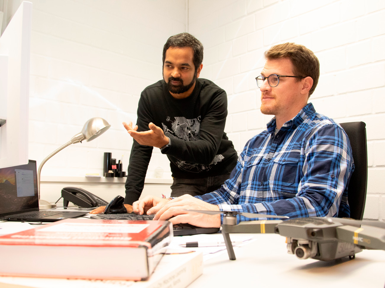
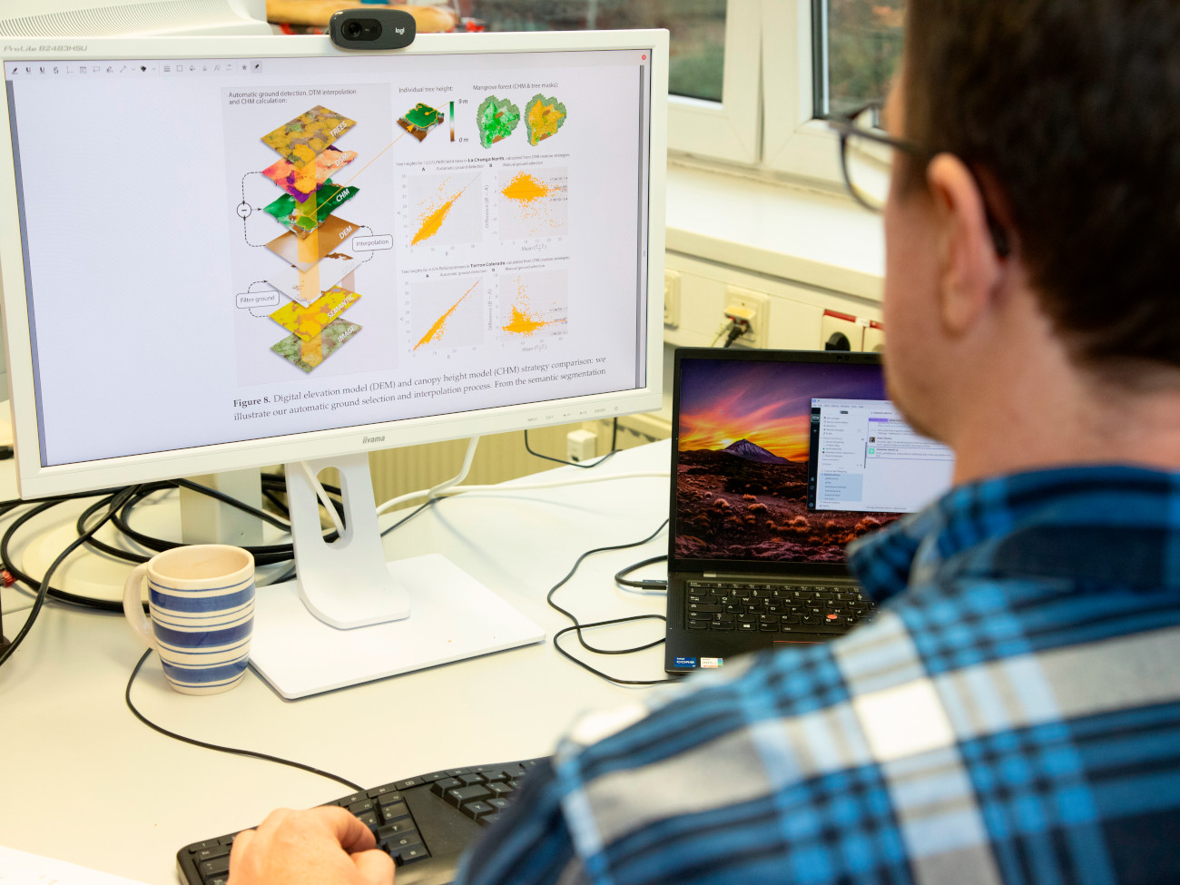
“Our goal was to develop a method that identifies every single tree in a forest and measures its biomass by calculating the tree crown, height, and circumference of the trunk. The more precise our information is, the more accurately we can determine the amounts of stored carbon and the better the trees can be monitored and protected,” Schürholz explains.
Researchers have previously created tree inventories for mangrove forests, mostly from the ground, but working in this terrain that is often not very accessible is a difficult and lengthy process. The areas are usually very remote, the ground is swampy, swarms of mosquitoes and other animals surround the area, and the tides limit access to the groves. “Usually, small plots are measured in larger intervals along the coast, and this data is extrapolated,” says Chennu. “The procedure is as arduous as it is susceptible to mistakes.”
The duo therefore relies on the most modern technology – on creating an aerial inventory using drones and artificial intelligence (AI). “These technologies open up completely new methods for charting habitats,” Schürholz explains. The Bremen group works in collaboration with the Columbian Universidad del Valle and the researchers Juan Carlos Mejía-Rentería and Gustavo Castellanos-Galindo, who once worked at the ZMT. Their research area was the remote Utría National Park on the Columbian Pacific Coast, home of one of the largest and most dense mangrove forests, which boasts trees with heights of up to 30 meters.
The Columbian colleagues took over the fieldwork, navigating the drones according to a specific pattern above the tree canopy and recording aerial images of the mangroves. In Bremen, Elisa Casella, a researcher at ZMT at the time, would compose the individual images into large, high-resolution mosaics of the forest’s surface; Schürholz then developed the AI for recognizing the trees.
That all sounds much more straightforward than it actually is. Treetops overlap and sometimes, despite having aerial images that are significantly more detailed than satellite images, it is difficult to determine where one tree begins and another ends. Schürholz spent weeks identifying more than 4,000 individual trees using the images, and then used the results to train the AI. “I was dreaming about trees,” the 33-year old remembers with a chuckle. The machine learning was effective. In the end, the AI was able to identify mangroves on its own – and able to differentiate between varying species. Tasks that had previously taken months could now be completed within hours: the algorithm identified a total of 34,667 trees of the mangrove species Pelliciera rhizophorae in the surveyed area, and also plotted an additional 30 hectares of red mangroves (Rhizophora mangle).
“The nice thing about the inventory is that each tree now has its own identity,” Chennu says. “We know its exact location and how much carbon dioxide it stores.” This is made possible by determining the diameter of the tree’s crown and drawing conclusions from this about the height, trunk circumference, and therefore the tree’s above-ground biomass. This can then be used to derive the tree’s carbon storage.
Experts estimate that more than one-third of global mangroves have been lost since the 1980s, releasing the carbon dioxide these once stored into the atmosphere.
Changes to the tree population are also easier to determine using AI-powered inventory methods, and these changes are enormous. Mangrove forests are under pressure, and have been for quite a while. Trees are felled to use the wood as fuel; forests are cleared to make room for agriculture, hotels, or aquacultures. Sewage, waste, and other environmental factors endanger the system. Experts estimate that more than one-third of global mangroves have been lost since the 1980s, releasing the carbon dioxide these once stored into the atmosphere.
The inventory created by drones and AI will help to make this process more transparent. “The standardized procedure provides decision-makers with reliable and reproducible data,” Schürholz emphasizes. Every year, foresters or other users can check the current inventory of a forest without much effort, which makes it much easier to preserve and sustainably manage the fragile ecosystem. An additional bonus is that the technology is inexpensive, which allows for much easier use. “The drones are standard products. Their sensors might only be able to provide low-quality data, but with our AI, we are still able to produce high-quality results,” Chennu explains.
© Jens Lehmkühler
Daniel Schürholz grew up in Peru, then came to Europe to pursue a master’s degree in computer science and followed this with a brief stint in the financial sector. He developed this AI as an integral part of his doctoral dissertation. “I want to use my knowledge for the greater good. I sought a topic for my doctoral dissertation which would make this possible and found it at the MPIMM,” he says in explanation of how his path led him to Bremen. “I am very happy here.”
“Bremen is a great place for marine research. The collaboration within the U Bremen Research Alliance is close and trusting.”
Physicist Arjun Chennu, born in India, also came to the MPIMM for his doctoral research – over a dozen years ago. In the meantime, the multi-award-winning scientist, who created a system for monitoring coral reefs known as HyperDriver, has moved to the ZMT. He sees Bremen as a great place for marine research, and the collaboration within the U Bremen Research Alliance as close and trusting. This was evidenced by MPIMM providing server capacity for the forest inventory project.
“Seeing the Forest for the Trees: Mapping Cover and Counting Trees from Aerial Images of a Mangrove Forest Using Artificial Intelligence” is the title of the article in which Schürholz, Chennu, and colleagues describe their universally applicable method of ecological accounting. They hope now that this will be used as widely as possible in other regions of the world. They have already received such inquiries. Of course, forests in Germany can also profit from this AI. It would just need to be trained with relevant images.
Sustainability as a Guiding Principle
Sustainability, climate justice, and climate neutrality determine the actions of the University of Bremen now more than ever. For the first time in 20 years, the core member of the U Bremen Research Alliance has modernized its mission statement, giving great importance to this topic. “The world is changing. That needs to be reflected in our mission statement,” says Professor Dr. Jutta Günther, president of the university.
For students and employees, this development means that sustainability and climate protection will play a more important role in all areas in the future. One example is the planned English-language bachelor’s program “Natural Science for Sustainable Future.” The university already has a good standing with these topics. The “UI GreenMetric World University Ranking,” which evaluates sustainability, ranked the university 10th place among 1,183 participating universities worldwide.
This article comes from Impact – The U Bremen Research Alliance science magazine
The University of Bremen and twelve non-university research institutes financed by the federal government cooperate within the U Bremen Research Alliance. The joint work spans across four high-profile areas and thus from “the deep sea into space.” Biannually, Impact science magazine (in German) provides an exciting insight into the effects of cooperative research in Bremen.